The post Brancepeth to Rag Path Wood appeared first on Bill's Walks.
]]>Start: Brancepeth Station Car Park on the Brandon to Bishop Auckland Railway line (GR NZ219382)
Click to view start position on Google Maps
Map: Explorer 308 – Durham and Sunderland
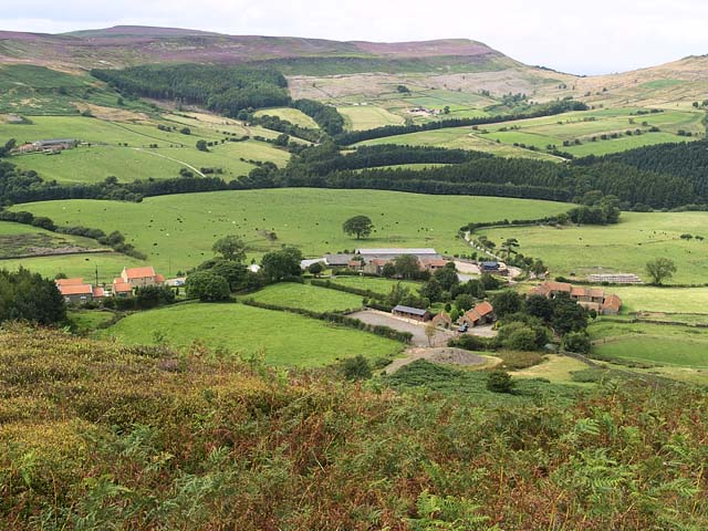
On quite a few earlier waiks I have highlighted some excellent reclamation work which has been carried out in the county, often on old colliery sites or railway lines and indeed this is to some extent a theme on this walk. The difference is that here much of the landscape change has been the result of open cast mining operations This walk is virtually entirely rural, yet a person doing the same route 50 years ago would have seen a totally different picture!
We start at the old railway station of Brancepeth on the Brandon to Bishop Auckland Railway Walk. The station was built in the mid 19th century to serve the estate village of Brancepeth which had been constructed to improve the route into Brancepeth Castle (visited on my Weardale Way – Sunderland Bridge to Page Bank walk). The line was built to carry coal and coke and was conceived by George Hudson who was known as the Railway King. However his empire had collapsed before the line was completed. The line incorporated the Durham City viaduct and was closed to passenger traffic in 1958.
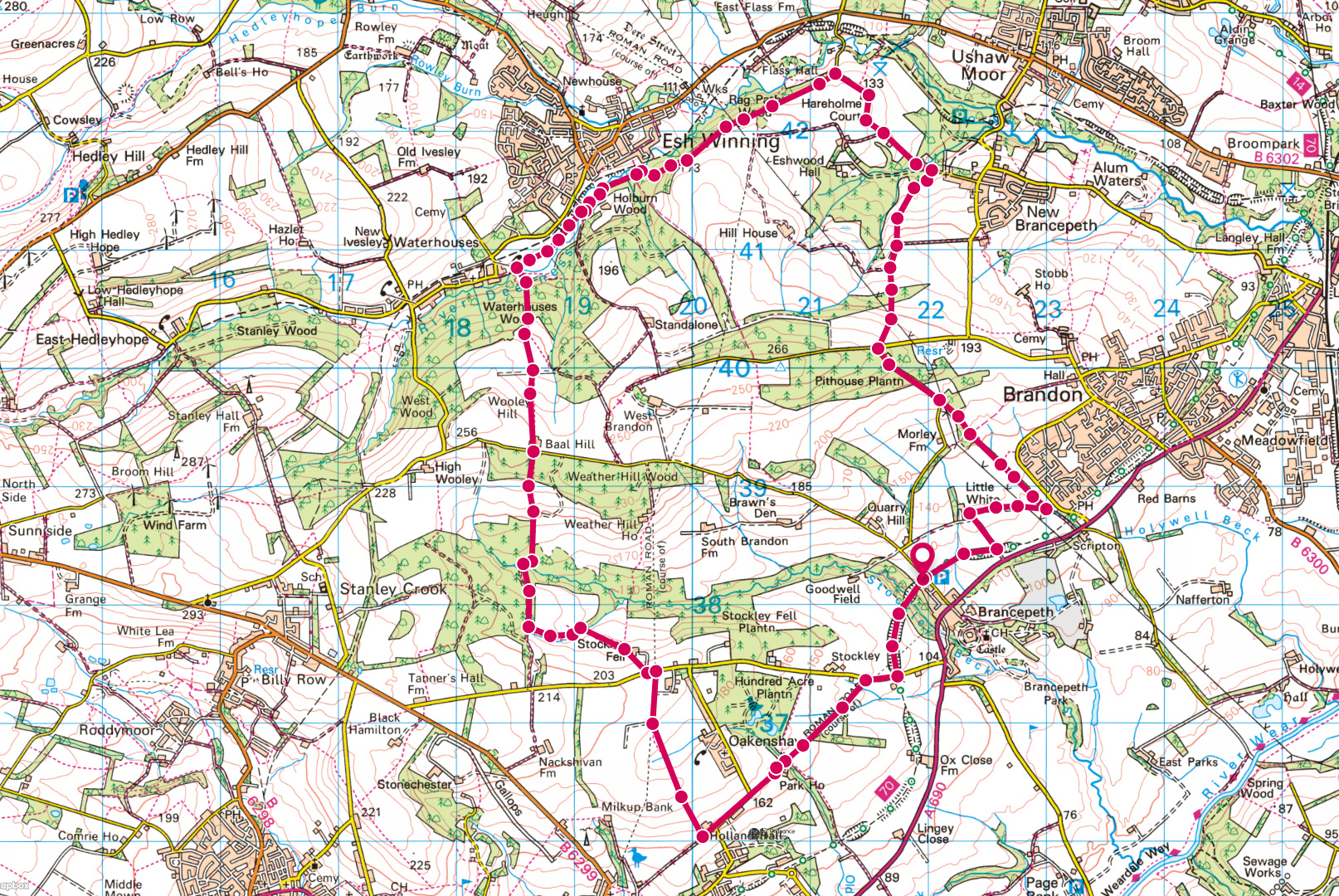
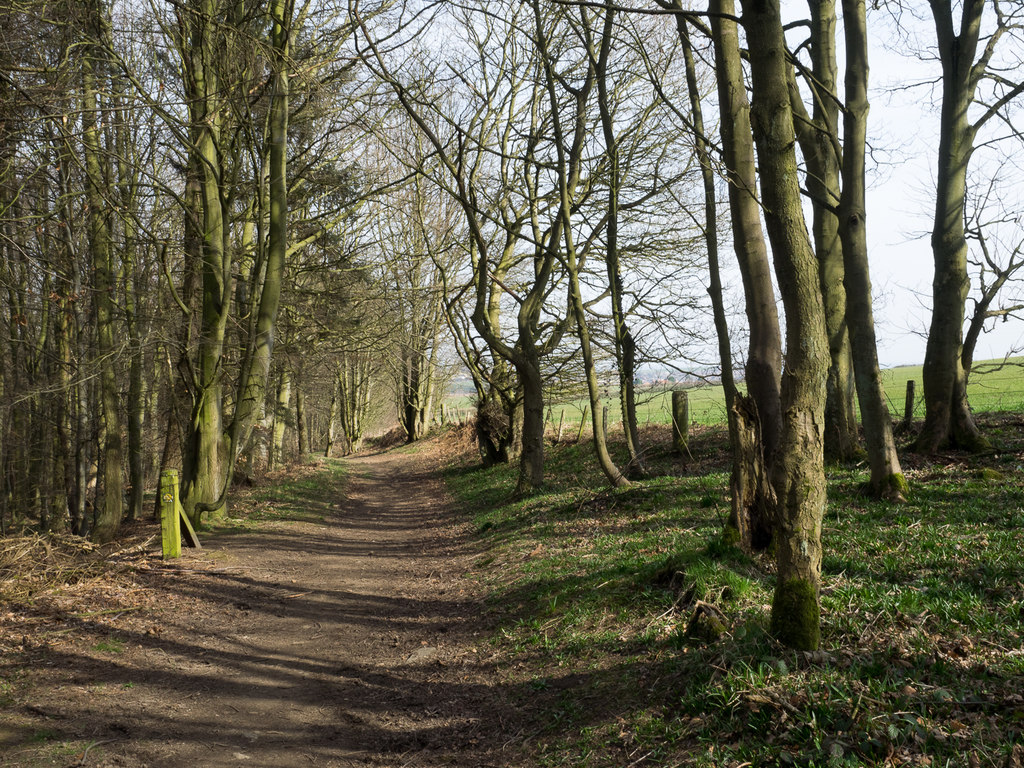
We proceed east along the line, turning to Littlewhite Farm and continuing to Scripton Gill. This narrow wood has: some good birdlife and some fine oak trees of a reasonable age and considering the proximity to Brandon is a pleasant spot. We follow the gill uphill to Pithouse East Plantation which on a clear day is a fine viewpoing over much of northern Durham as well as the nearby Deerness Valley. On the ascent keep an eye or an ear open for the woodpeckers and squirrels that live in the woods through which you pass.
We now begin to drop down towards the Deerness, noting Ushaw College in front of us on the other side of the valley. This is the primary centre of the Roman Catholic Church for the training of priests in Northern England having been established in 1808 after earlier locations at Pontop Hall (passed on my Pontop Pike Walk) as well as Crook Hall near Lanchester.
We emerge at the road frorn New Brancepeth to Esh. New Brancepeth had a large colliery which opened in 1856 and mined coal from a depth of 70 fathoms. It closed in 1953 and for its last few years also mined fluorspar. We now go west to Ragpath Wood. This general area is good for Tree Sparrows which are a threatened species.
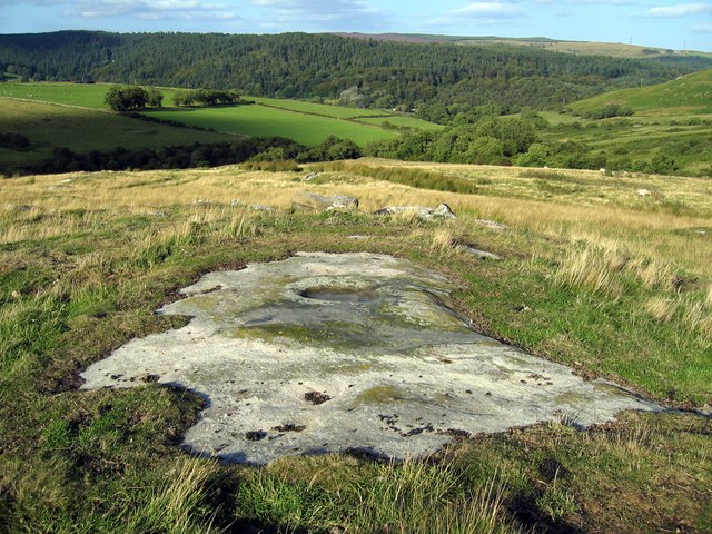
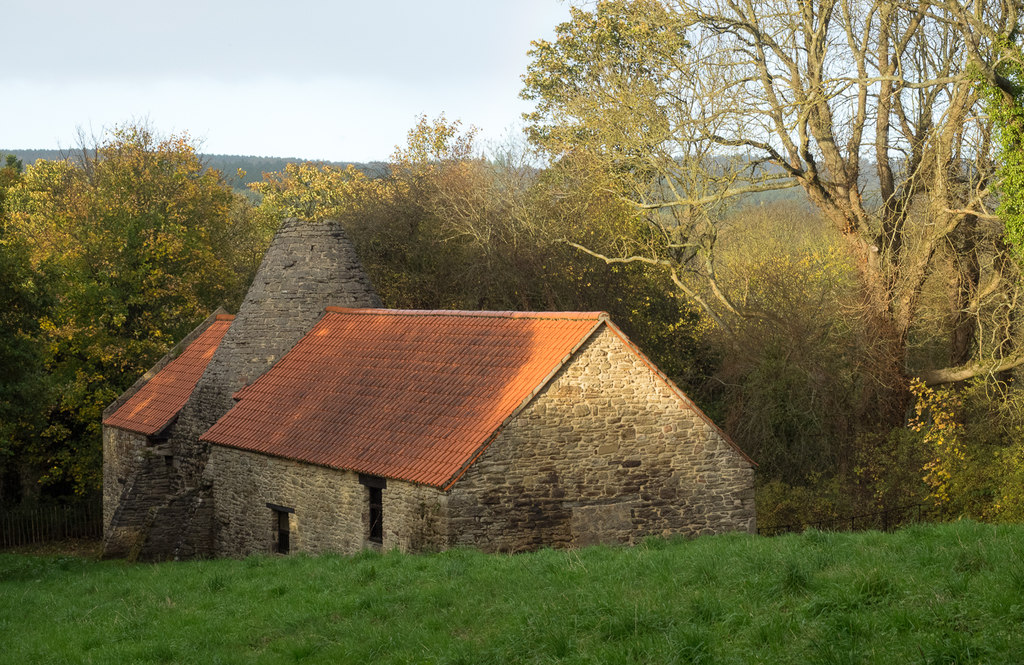
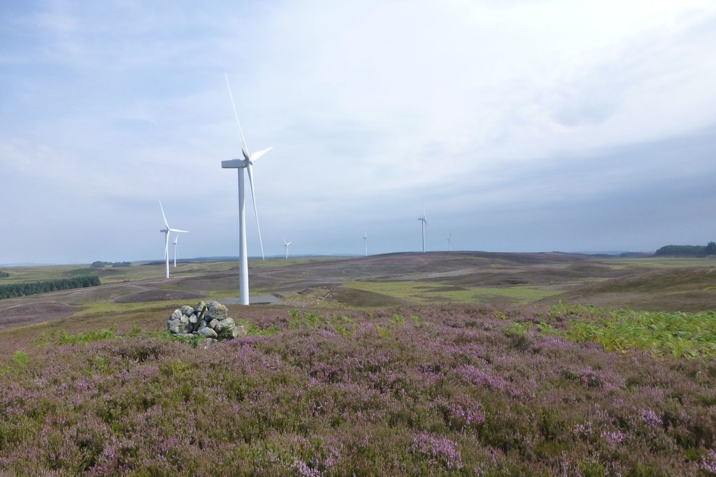
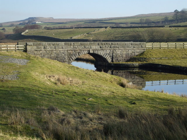
Rag Path Wood
We now enter Ragpath Wood where the road turns sharply downhill to the river. This wood was purchased by the Woodland Trust in 1996 following an approach by concerned local residents regarding its long-term future. It is an Ancient Woodland site which was replanted in 1967 following the old site being felled during WW2. It occupies a site of 31 hectares and currently consists of Scots Pine, Larch, Norway Spruce, Sycamore, Beech and some Oak and Birch. The long term plan is to harvest the softwood and replace it with hardwood and restore the wood to its former glory. The undergrowth is of Heather, Bilberry, Gorse and Broom whilst near the river can be found Wood Anenome, Wood Sorrel, Butterburr and Ransoms. It also contains some fine ancient beech trees along the southern edge of the wood at its westward end. This wood has been developed by the Trust with financial help from Durham County Council, the local Parish Council and Durham City Council and was aided by a grant of £17k from the Heritage Lottery Fund.
The bridle path which you go through at the southern edge of the wood is thought to be an old Roman road which had defensive purposes and followed the ridge east to west. There was a similar one on the other side of the valley which went down to the site occupied many years later by the monks at Beaurepaire (Bearpark).
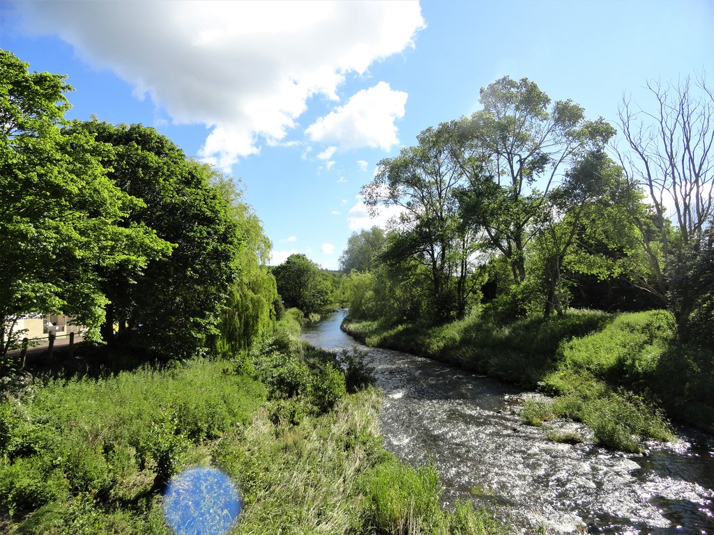
We emerge from the wood near the River Deerness with the Deerness Valley Walk on the other side of the river. This railway was opened in 1858 to carry coal out of the valley and had branch lines to New Brancepeth, Cornsay, Stanley Crook (up a steep incline), Hedleyhope and Ushaw Moor and was closed in 1951, except on one day a year when it was open on miners gala day. Esh Winning on the other side derives its name from Esh (a corruption of Ash) and was the place where the coal was won. There has been considerable environmental work carried out here with new plantations and hedgerows and it is through one of these plantations that we go, later passing the site of earlier drift mines to Baal Hill. This unusual name, associated with pagan gods and the Middle East may have a history and indeed there is another Baal Hill near Tunstall Reservoir. However the name may also be a local mining term.
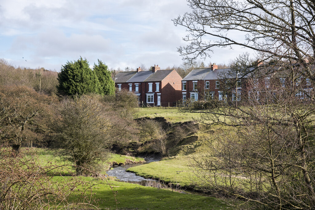
River Deerness at Esh
Stay on the south of the River Deerness passing a row of houses and through an attractive area to reach a footpath leading to Baal Hill (at GR 186408) and climb up for 100 metres. Continue south of Baal Hill and drop down through pleasant woods to two small lakes at Stockley Beck, then turn east to eventually pass Stockley Fell Farm and reach Stockley Lane. Crossing this we go south along the site of Dere Street (with the village of Oakenshaw to the east) and the path is followed to Holland Hall. This is on the site of another Roman road which joined Dere Street about half a mile to the west. We now pass Park House on the line of the Roman road to arrive at Stockley Lane near to the Railway walk.
It is now a short distance back to the start, crossing Stockley Beck, where the valley is now much enlarged. This deep valley formed part of the defences for Brancepeth Castle. Much of the land traversed from Pit House and back from Esh has in the past 30 years been subject to opencast mining and this can be noted on the new stone walls and new hedgerows.
The post Brancepeth to Rag Path Wood appeared first on Bill's Walks.
]]>The post “The Early Start” or “A Day to Remember” on the Calderdale Way appeared first on Bill's Walks.
]]>At the time of this walk which was in the 1980s, we had all known each other for a considerable time and in the intervening years, whilst some are not as capable of doing the distances we did then, we are still capable of causing considerable chaos whether it be long distance walks or cycle rides. The write-up was from Harry Waters who was not out on that day and possibly felt superior because of it. How wrong he was, as was witnessed a few years later on the Five Sisters of Kintail in Scotland – but that is another story, which he would not write about!
The section to be walked was a 13/14 mile easy part of the Calderdale Way, close to Halifax. Sunday morning for the keen, intrepid walkers of Whickham. Bill Gallon, never the best riser around, was picking up Ken, Alan L, John and Brian at 7:20am. Well, I should say he picked up Ken, Alan and John, but as usual something had to go wrong. Brian was still sound asleep in his bed! He was on a course of antibiotics for a wracking cough, which made him sleepy and have diarrhoea; but personally I’ve never known him to be otherwise.
After waking Brian, and half the street, and after a seemingly endless delay, Brian eventually extracted himself from bed and house and duly reported to his knocker-uppers. He was then asked, as there were too many people for Bill’s car, if it was possible for him to use his car as well. As usual, Brian did not have his front door key, so after getting his wife and half the street out of bed again, he eventually found his car keys. Alan and John were already in the car (the door lock was not working properly). Alas and alac, to Brian’s dismay, he had brought out the wrong set of keys! He is an affluent type with two cars! Once again, half the street and his wife arose to ensure that this time he did have the right set of keys.
The next stage was to drive to Durham to meet up with another Alan (Stewart), who lives in Chester le Street, but arranged to meet them at Durham (sounds complex). However, as they approached the outskirts of the city, Brian suddenly exclaimed “Dearie me, I’ve forgotten my boots” or words to that effect. Confusion, speechlessness and unprintable words followed, but after the initial shock they decided to carry on, meet the others first and then decide what action to take. On arriving at Durham, instead of finding Bill with his car along with Ken and Alan S, Bill was nowhere to be seen! “Where is Bill?” asked Brian, Alan L and John to which Ken replied “He’s gone back home to Whickham!” “Why?” they asked in dismay. “For petrol” said Ken. “Why couldn’t he get some on the way?” “Because he’s forgotten the key for his petrol cap!” Ken replied. With good foresight they rang Bill’s wife who woke up their son and dispatched him forthwith to Brian’s house for his boots. By this time Brian’s wife and half the street were up in any case.
Eventually, on Bill’s return with petrol and boots they set off in Alan and Bill’s cars, leaving Brian’s car in Durham – it’s a little old and the other two were modern and reliable. It is a lengthy journey to Halifax and it was already getting late. However, first of all they had to pick up Neville from Darlington, who would be waiting for them at Scotch Corner. When they arrived, Neville was nowhere to be seen, so after more delay they decided to go on without him. Unbeknown to them, Neville had arrived at the pick-up point some ten minutes late, having spent the previous night at his parent’s home in Teesdale, and assuming that he had missed them, set off in hot pursuit.
The happy walkers at long last reached their starting point some two hours late. The plan was to split up into two groups with one lot at point A at one end of the section and the other group at point B at the other end. Hopefully, sometimes by luck and sometimes by skill, the two groups would meet each other half way, give or take a couple of miles, and swap car keys, enabling them to reach the cars and sometimes have to find them with the correct set of keys. Simple really!
Funnily enough, four miles into the walk the lads from Whickham suddenly bumped into Neville, jogging towards them. Having failed to meet up with them at the start, he realised that once he had reached the end of the day’s section, his only option would probably be to retrace his steps and jogging was the only answer if he was to have any chance of returning to his car before nightfall.
May I add that all the lads had a great day and an enjoyable walk and reached their homes at a respectable time without further mishap. Me? Well I had thought of going with them but chickened out and stayed at home to argue with my good wife. Well I mean, fancy her wanting to cook the Sunday dinner while i am laying tiles around the oven. After all it is only six months since I started the job. Still only need eleven tiles to finish; perhaps sometime in the next six months? Meanwhile, I’m looking forward to some great winter walks in the snow up in the hills with Brian, Bill, Alan L, Alan S, John, Ken, and Neville.
Harry Waters
Postscript: In the years following this walk many other long distance path were walked and we each had our favourites. In spite of being intimately involved with the Pennine Way my own favourite is Offa’s Dyke. In all of the years there have been many escapades and we have never had an dissention within the group which over the years has extended to a number where we recently had 22 for a Christmas dinner (and a few bevvies!) where the above account was read out (after a long period of being filed away with the Calderdale books) amidst much mirth. Many of us were featured on Radio 4 on the 50th Anniversary of our walking and cycling trips on the programme “Home Truths” which was originally chaired by John Peel, although he had sadly passed on when the programme was made.
The post “The Early Start” or “A Day to Remember” on the Calderdale Way appeared first on Bill's Walks.
]]>The post Local Walks in County Durham appeared first on Bill's Walks.
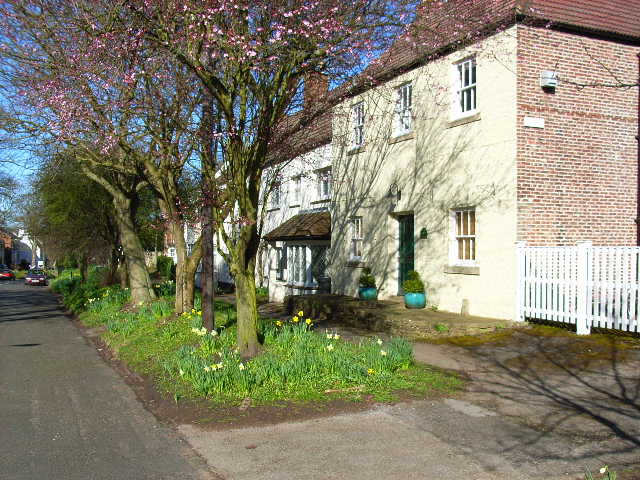
]]>The first one is a set of walks around the very attractive large village of Wolsingham in Weardale. There is rarely a month goes by that I do not spend some time in Wolsingham as the surrounding countryside is top class and full of interest. Wolsingham Wayfarers have been around for about twenty years and they have produced six leaflets of walks varying in length form about 2 miles to about 13 miles. Each walk has a different agenda in different terrain and the walks have all been well constructed. In the last three years the leaflets have been updated. The combination of the clear maps and route descriptions make route-finding simple, although it is my policy to always have the relevant OS map(s) available. For those from further afield I can warmly recommend that you visit Wolsingham and Weardale which has all the facilities that you may require and keep an eye out for the spotted flycatchers which are found hereabouts. The website will give you any other information that you may require.
Wolsingham Market Place
Shincliffe is an attractive village which is split into two separate villages. The old village is close to the River Wear, whilst High Shincliffe is about half a mile to the south along the A177. There is a lot of heritage in both villages. The Parish Paths partnership which is funded by Durham County Council have produced a leaflet with more than adequate route descriptions which contain four walks starting from Shincliffe village and one walk starting from High Shincliffe at the north end of the village, where there is good parking. These walks are a lesser distance to the Wolsingham walks. To obtain the leaflet it will be necessary to Google ‘Shincliffe Walks’. For those who wish to start in Durham city, this will add about five miles to the walks by following the River Wear to give a walk of about eight miles and be time well spent!
Springtime in Low Shincliffe
The post Local Walks in County Durham appeared first on Bill's Walks.
]]>The post The Pannierman Way, Cold Moor and Urra Moor appeared first on Bill's Walks.
]]>Start: Kirkby in Cleveland (GR 542042)
Click to view start position on Google Maps
Map: OS Explorer OL26 – North York Moors Western Area
It was in early November 2011 that George Howe asked if we had walked on the Pannierman Way out of Kirkby in Cleveland and received a negative response from the seven of us. Being an anorak on pack horse bridges my interest level was high and after a period of three weeks (during which we had other committments) a day was planned for George to show us his route. Knowing that George always searches out lesser known paths and quirky places we were keen to have a look at his route. The walk starts near Kirkby in Cleveland and a look at the relevant North York Moors OL Map 26 showed this to be just to the west of Great Broughton. Closer examination showed a Pannierman Lane name for part of the A172 leading out of Nunthorpe and an extrapolation of this route after leaving Stokesley leads down a minor road to Kirkby.
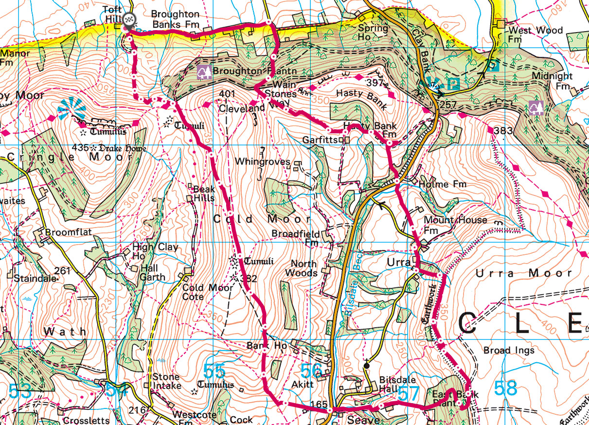
The inspiration to George was an article in I believe ‘The Dalesman’ magazine (always a good read) which stated that an ancient paved footpath had recently been revealed climbing up from Kirkby onto the Cleveland ridge where it crossed the Cleveland Way and headed south. The catalyst for this discovery and the work that followed is due to the efforts of the Kirkby, Great Broughton and Ingleby Greenhow Local History Club. Their work and activities are well documented on their website and the group believe that the path was built by the lay brothers of Rievaulx Abbey.
Anyone who walks these hills cannot fail to be struck by the host of ancient tracks, earthworks and crosses all dating from both the distant and more recent past and many books have been written on the subject. As well as this several walks have been devised which visit many of the sites. The more recent landscape features go back two centuries where the spoil heaps are often all that is left of the extensive mining which took place hereabouts. The tracks and crosses are a different matter all together and many of them are medieval and even older. Many of these are pack horse routes similar to those in the South Pennines and Calderdale where they were often paved to facilitate easier access. The local group uncovered evidence that their route was paved and were fortunate to get the Royal Dragoon Guards to clear the route and the associated ditch and expose a long line of flags leading upwards to the ridge. Christopher Evans who has written “Trods of the North York Moors” published by the Scarborough Archaeological Society believes that this route was used to carry fish from the Tees into the hinterland and to Rievaulx, which concurs with the local group. Another cargo was probably salt from Teesmouth, then a pristine marsh area, and other salt routes from Teesmouth spread out in the area. Search the map for Salters Way and you are almost certainly on an old route. There is even a pack horse bridge on a route at Ketton just to the north of Darlington. On old maps the Pannierman Way is marked as a bridleway to Bilsdale and indeed a closer look at the area does indicate that this route was probably the easiest way over the Cleveland Hills.
Further news from the Local History Group shows a visit from personnel from Natural England as they believe the route should be listed and therefore receive better protection and in my view this is essential as there is already evidence of damage caused by motorised vehicles. Whether these are in the normal activity of sheep farming or from illegal motorcycles l cannot say.
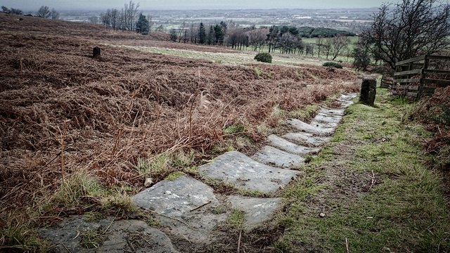
Kirkby Bank Trod
The walk starts at the end of the lane to the south of Kirkby at Toft Hill, about one mile to the south at GR 542042. The OS map which l have was published in 1995 and the route is shown as a dotted line but it has since been altered to a permissive route. The flags are all exposed and the scenery here is very attractive when heading south and then twisting up through some old mineworkings to eventually emerge onto the Cleveland Way beside the corner of Broughton Wood at GR 546034. It is now straight ahead on the clear track and after three stiles you reach the open moor on Cold Moor at GR 552024. The right of way on the path has disappeared and is in the heather but there is a clear track nearby to the Three Howes. The valley to the right is the little known Raisdale.
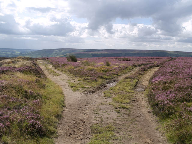
Heading south on Cold Moor, the track forks beyond Three Howes
Just after the Three Howes there is a split in the track near a tumuli and the one to the left is taken, heading gradually downhill in a south-east direction, where it picks up the true route at GR 555101. It is now steeper downhill to Cold Moor Lane with a plantation on your left. Ignore the first path on your left and take the second down to Seave Green. Note the superb sloes on the overgrown hedge on your left before arriving in to Bilsdale and the B1257 Stokesley to Helmsley road where there is a welcoming seat at Seave Green.
The route is straight across on the access road to East Bank farm (which is a steady climb) and you pass behind the farm to continue up to East Bank Plantation. Continue upwards and nearing the top the gradient is eased by the path cutting across the slope. Near the top where you emerge from the wood are substantial earthworks heading north all the way to Urra Moor. The entry to the bridleway is very wet and tussocky and it is easier to continue upwards a further 100 yards to the broad track on the level ground which is taken north towards Urra Moor. This is a good place for lunch with views down Bilsdale and across to Cold Fell. This track soon comes to a t-junction and you then drop down to the bridleway along the earthworks near Medd Crag. The track to the east goes up to Round Hill on Urra Moor, which is the highest place in the North Yorkshire Moors and is on the Cleveland way which would make a longer walk if you feel fit.
Urra viewed from Urra Moor
Our route today continues along the bridleway to a dip where there is a waymark leading downhill at GR575019. This is a steep track and after passing through spoil heaps it reaches a substantial house at Urra and tarmac. Go right and where the road goes left and downhill at Urra farmhouse look for a difficult stile on the right. This serves two paths and the one we want is the one heading north-west, diagonally across two fields and then down over a stream by a footbridge and a short climb back up to the B1257. This is crossed immediately and a very stiff climb up through the trees is met. Keep a little to the right and not up the minor valley until you reach a marker stone where the semblance of an old path is met. The gradient eases to a stile which is crossed into a field which always has crops in it. Look for the path through the crops to reach a concrete lane via a stile. The landowner here has planted many fine trees including a tulip tree. Go right for a short distance to a gate where a path is taken on the left.
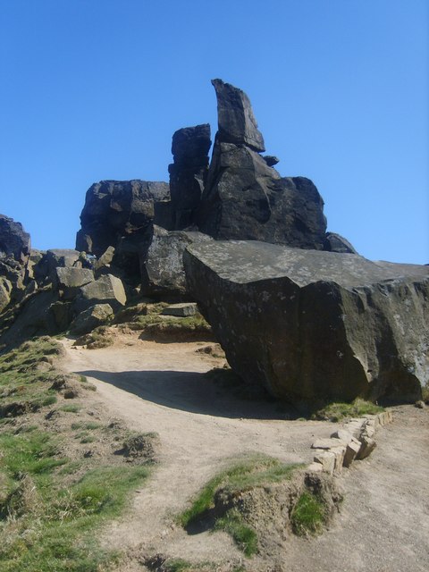
The Wainstones on Cold Moor
On our visit the view of Hasty Bank farm was obscured by the crops and the path has been diverted here to bypass the farmhouse. The path passes Garfitts and then drops down to a very wet section over a small stream and heads north-west to join the Cleveland Way at GR 557035. If you keep up towards the wood after Garfitts you can stay on higher but much drier terrain. There are good views of the Wainstones on your right where there are carved ancient stones. You cross the Cleveland Way which climbs westwards back up the northern end of Cold Moor and instead continue in the same direction you have been walking to a gate and the edge of Broughton Plantation. Just to the left is the forestry road heading slowly downhill in a north-east direction. After about 250 yards look out for some steep steps heading downhill and take these to join another forest road near to a junction which is waymarked to either Clay Bank or Great Broughton. Take the Broughton direction and arrive at a tarmac road at GR 556043 at the head of a road leading to Great Broughton. From here it is one mile back to the start by taking the bridleway on your left passing by Huntons Folly and Solomons Porch.
Grateful thanks to George for this fine route and special thanks to the Kirkby, Great Broughton and Ingleby Greenhow Group and their Chairman Geoff Taylor for all their work on this and other projects! The day had an additional surprise at the end as the Black Swan at Kirkby was surprisingly open at 4.30pm on a winter Wednesday and Farmers Blonde and Copper Dragon were enjoyed as well as large mugs of coffee!
The post The Pannierman Way, Cold Moor and Urra Moor appeared first on Bill's Walks.
]]>The post Walking Round in Circles appeared first on Bill's Walks.
]]>After this we took a compass bearing north and proceeded to head in that direction ,without any further consultation of the compass, fully anticipating to emerge at the side of Slaley Forest which hereabouts runs in a broadly West to East direction for over two miles. After about three quarters of an hour we discovered what we thought was another colony but to our surprise had walked around in a complete circle and arrived back at the original colony! We had heard, like most of us, that when lost people tend to walk round in circles and we therefore took out our compass and walked on a north bearing (this time keeping an eye on the compass!) until we reached Slaley Forest, turned west along the forest edge and descended into Devils Water where there was some limited visibility.
In an article in an issue of “Strider”, which is the journal of the Long Distance Walkers Association, in mentioned that walking in circles is natural. A group based at the Max Planck Institute at Tubingen in Germany recently carried out a study into this phenomenon. The researchers used GPS to track peoples routes both in a large forest and in the Sahara Desert. Whilst walkers trying to keep a constant direction were able to follow a fairly straight course if the sun was visible they tended to walk round in circles if they could not see the sun or any other distinct landmark. They also observed walkers trying to go in a straight line when blindfolded and found that they walked in surprisingly small circles, often in a diameter of less than 20 metres (yes, twenty!). The paper in “Current Biology” suggests that walking in circles is a result of accumulating noise in the sensorimotor system.
The problem is of course resolved by always having your compass with you and using it continually if there is poor visibility and no known landmarks. Some might even add, do not walk with noisy people and l wonder who they might be!
The post Walking Round in Circles appeared first on Bill's Walks.
]]>The post A Different Walk from Rothbury appeared first on Bill's Walks.
]]>Start: Rothbury, Northumberland (GR 058016)
Click to view start position on Google Maps
Map: OS Explorer OL42 – Kielder Water. Bellingham and Simonside Hills
A bright late November day tempted us to go into the hills in the Coquet Valley for a change. Most walkers going out of Rothbury make for the high ground of the Simonside Ridge to the south or the well known terrace walk to the north but on driving into Rothbury from Weldon Bridge the idea was mentioned to go to a quieter area downriver from Rothbury on the south bank. It was over a year since any of us had set foot in that region.
From Rothbury proceed down to the river which is crossed on the roadbridge and the B6342 is taken up the hill towards Scots Gap. After about 300 yards take Mill Lane which leads off to the left and soon leaves the houses behind. It is level going looking down to the Coquet and in the early stage the small industrial estate which was formerly the site of the railway station which served Rothbury and terminated there. We shall meet this line in several places in the first half of the walk. It was opened in 1869 by the Northumberland Central Railway and was supposed to go from Scots Gap to Ford near Wooler where it would link with another line at Ford which went to Berwick. Due to a lack of funds however it never went further than the first stage to Rothbury and in 1952 it closed to passenger traffic. The final end came in 1963 when it was closed altogether and now only the trackbed survives in some places. What a pity that Northumberland County Council showed so little imagination in not buying the track bed (which they were offered) along with other Northumberland closed lines to convert into a a superb network of bridleways, through beautful country, which could now be generating income for rural communities.
River Coquet from the Stepping Stones in Rothbury
The lane changes to a path at Wagtail Farm where the lane and the railway are crossed and we continue descending down towards the river. The trees opposite look particularly good in Autumn and are part of the Cragside Country Park. The path now enters an old wood where the way is marked by a combination of signs and yellow tape round trees which should be followed as it is quite wet underfoot off the track. The path eventually starts climbing uphill towards the end of the wood to arrive at a wall which was alongside the old railway line. The track here has been through a rock cutting with an old footbridge over. At a level crossing soon after we leave the line to pass by a derelict cottage called Craghead. The occupants obviously had great difficulty in getting large furniture away when they left as, at the time of writing, there is still an old piano and kitchen equipment left behind from a bygone age!
West Raw farm seen from St Oswald’s Way
From Craghead a clear track heads east through the fields to West Raw where tarmac is reached. Here head south to Butterknowes and its small lake and then a little further to East Raw. In front of you are two footpaths and the one on the right is taken (signposted ‘The Lee Head’) to head straight down the field towards the wood, where you cross a stile to head downhill to the Forest Burn. This is crossed by a footbridge and a path taken up the south bank through a pleasant conifer forest where there are also beech trees. Heading upstream you cross a field before going back into the forest where there is currently wood being harvested. After about 500 yards it is necessary to cross the river which can be a bit tricky. In the summer the river can be easily crossed but on this occasion it was necessary for us to ‘plodge’ (in English wade) through water about one foot deep. Be warned and pick a dry spell if you object to getting wet feet. A further river crossing soon after is much easier and the path then reaches a road where there is a ford for vehicles and a footbridge for walkers and cyclists.
The footbridge is crossed and the bridleway on the left taken slightly uphill to The Lonning which is probably an OS spelling mistake as the sign for the house is the The Lonnen. Pass in front of the two houses and take their access road west. This arrives soon at the access road to The Crook which is down to the left and we continue west passing a house on the site of the railway crossing where an old LNER gate survives. At the B6342 turn left for 100 yards and then right to Blagdonburn Farm where you are guided through the farm buildings on your right. Then follow the track west to the fence at the end of the first field. In reasonable visibility look north-west for a house called Spylaw and a small wood about one mile away. Otherwise set a north-west bearing. It is a steady plod upwards mainly on good grass with over 100 metres (325 feet) of ascent up to the wood. There is a path then heading north-east which reaches the car park at Lordenshaw after one mile but a preferred way is to follow a good track which also heads north-east a little further east, crosses over the top of Grain Sike to arrive at the road at GR 056983 just to the edge of a wood.
Large sandstone outcrop at North Lordenshaw
It is now a short walk uphill on the road passing the entrance to Lordenshaw farm on your right to arrive at the car park for the ascent of the Simonsides. The last two miles have glorious scenery and the panorama continues on the route north ahead to the stones with the cup and ring markings. One is close to you on the left on reaching the top. The paths here are lovely close cropped turf which is a joy to walk on. It is all downhill now for about 120 metres (400ft) to Whittondean, where their access track is taken to a t-junction where you turn right down to Whitton. At the road turn right for a few yards to where the road turns right at a bend and go towards the house where you will find the foothpath which exits into a large field by a kissing gate. Again it is north and downhill with Rothbury at your feet, to a stile where you then take a road downhill to the river. If you are going back into the town or want the riverside car park turn left for a short distance, cross the Coquet by the footbridge and reach the main street by the lane in front of you.
The post A Different Walk from Rothbury appeared first on Bill's Walks.
]]>The post Milkwellburn Wood Nature Reserve, Chopwell Woods and The Derwent Valley appeared first on Bill's Walks.
]]>Map: OS Explorer 307 Consett and Derwent Reservoir
Start: Ebchester Station Picnic Site (GR NZ 107548)
Click to View Start Position on Google Maps
This walk starts at Ebchester Station which has good parking facilities and is on the Derwent Walk. Plenty has been written about the Derwent Walk on other walk descriptions but suffice to say that the line opened in 1867 and was closed in 1962. Ebchester Station itself closed on 21/9/1953. The line had reached its peak around 1914 when it carried half a million passengers annually but the combination of improved roads and the fact that the line had to achieve considerable height to reach Consett meant that the line left the valley bottom (and hence much of the local population) led to a big reduction in passenger numbers.
We start by walking north down a gradual descent and passing a small dene and wood on your right which comes down from the housing estate called The Dene. This is a good spot to see roe deer and also I have seen jay here in the past. At the bottom of the slope there is a crossing of paths with one linking Ebchester to Medomsley and we take this downhill to reach Ebchester down a hedged lane. There is an option halfway down to leave this and follow the clear path down the field although this is not shown as a right of way. Whichever way you choose you soon arrive at the church of St Ebba. Much of this was built utilising the stone from the nearby fort of Vindomara hidden behind the houses opposite. The church is possibly pre 1066 but is probably early Norman and was substantially restored in1878. It retains the leper window which allowed those inflicted to watch the service (and hopefully to hear the service) without coming into contact with the congregation. Ebba was the daughter of Aethelfrith who was the first king of Northumbria. The church organ was made by the famous manufacturers Harrisons of Durham who made organs in Durham City for many cathedrals and now operate from Langley Park near Durham.
St Ebba’s Church in Ebchester
After the demise of the Romans the area became dense forest rising upward from the River Derwent and later, in the time of Bishop Pudsey, it was known as the place of the Anchorites who were hermits. Ebchester is different from the other forts on Dere Street in that the modern settlement is built over the fort compared to Lanchester and Corbridge where the fort is outside the village.
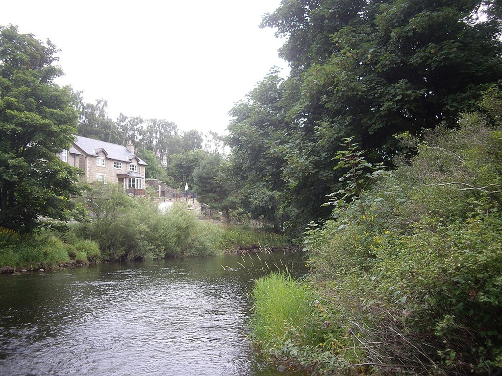
You now descend to the main road which is crossed and currently turn slightly to the right to an open space where there is an information board on Roman Heritage. This is subject to a footpath diversion slightly to the south of the current route which has not yet been completed. Walk down the steps to join a lane where you turn right to reach the River Derwent at a good footbridge. This replaced stepping stones some time ago which were dangerous after heavy rainfall. The remains of them can be seen a shade downstream. At the far side there are two paths one of which heads roughly north across the field to Broad Oak Farm. The other alongside the river was created in 2010 as a public right of way following a claim by Mr Marston (a resident of Blackhall Mill) and others under Section 31 of the Highways Act of 1980. This states that “where a way other than a way of such a character that use of it could not give rise at common law to any presumption of dedication, has been actually enjoyed by the public, as of right and without interruption for a period of 20 years, the way is deemed to have been dedicated as a highway unless there is sufficient evidence that the landowner demonstrated a lack of any intention during this period to dedicate the route. The 20 year period applies retrospectively from the date at which the right of to use the way was brought into question.” Mr Marston had much support from locals who confirmed this and the path was made into a right of way in 2010 by the Inspector from DEFRA. It is indeed an important path as it goes alongside the river which is particularly attractive hereabouts.
The River Derwent at Blackhall Mill
The River Derwent is the best otter river in northern England and also has the highest number of dippers measured by the numbers over a specific distance. You rarely fail to see dippers on this stretch and there are regular kingfisher sightings and occasional goldeneye. The path follows the river down to Blackhall Mill utilising the good quality gates en route, having been joined by a footpath from Broad Oak just prior to reaching the houses and having crossed Milkwellburn over a bridge.At Blackhall Mill take the unsurfaced road leading south for a short distance and then heading north-west to reach the entrance to the reserve at GR NZ 114570. This reserve is owned and managed by the Durham Wildlife Trust as it is in Gateshead, the Milkwell Burn being the boundary between Gateshead and Northumberland to where it joins the River Derwent.
The Durham Wildlife Trust operates within the boundaries of the old County Durham pre 1974. Milkwellburn Wood is the DWT’s largest woodland and is a long-term project which is undertaking a process known as PAWS restoration. This is known fully as Plantation on an Ancient Woodland Site and the aim is to gradually remove the conifers so that the native woodland can establish across the site dramatically improving the area for wildlife. The wood is dominated by oak and ash with locally rare small leafed lime and an understory of hazel, holly which is very prevalent throughout the Derwent valley and honeysuckle. The most dramatic change the restoration process triggers is the regeneration of ground flora as the conifers are removed and light can once again reach the woodland floor. The ground flora abounds including greater woodrush, primrose, bluebell, dogs mercury, and many ferns such as hares tongue and lady fern. In other parts of the reserve there are sandier soils and indeed this is evident in the nearby Broad Oak Quarry nearby to the south and here a heathland community develops which is now comparatively rare with bilberry and common cow wheat. There are also areas of alder woodland where you might be lucky and spot a siskin. Other birds which may be seen are tawny owis, sparrow hawks, garden and willow warblers, blackcaps, and woodcc;ck. On the recent visit both buzzard and red kite were seen gliding overhead.
The main track in Milkwellburn wood
There are numerous tracks within the wood which will hopefully be marked up more in future and also a public path to Newhouse Farm. Other entries to the reserve are at Chopwell (Whinny Leas at NZ 112578) from South View and Whittonstall Road at GR NZ113583. It is difficult currently to give easy directions in this wood but basically as long as you tend towards Newhouse Farm you will find a route that will exit you at one of the other entrances or it is better if you can keep going to reach the course of the old waggon way which runs along to the north-west of the wood at the top and can be reached at GR 104585 where there is an exit from the wood. Access is allowed throughout the wood.
Here you proceed to your right along the waggon way with Ashtree Farm high up on your left and arrive at a place with a newly planted wood on your right and a good path leading down to the houses at Chopwell. Turn left at the first road which curves round to join the main road through Chopwell at a tight bend. Here join this road and go left past a church. Turn right at the next bend and go downhill passing a school on your right. The tarmac path continues downhill towards Chopwell Woods passing a large open park on your left. There is a clear entrance to the woods next to the houses. The path is then followed into the wood for a distance of about 500 metres and reaches an internal road at a junction where the road heads east downhill to Carr House. Take this route where there is a burn on your right and eventually exit the wood to arrive at Armondside just outside the wood.
Derwentcote Steel Furnace
Here turn right towards Backhall Mill to arrive at the road bridge which is crossed. Take the footpath immediately on your left which leads to Derwentcote Farm. At the farm gate leave the path leading up to the A694 and double-back along a good route alongside a paddock to reach Derwentcote Foundry. This path was subject to a diversion a while back due to a landslip but the path has now been well restored and is no problem. The foundry was built in the 18th Century and is the earliest and most complete steel making furnace to have survived. It has been restored by English Heritage and is open to the public. In fact Channel 4’s Time Team featured the site on an episode which can be viewed here on YouTube. On reaching the A694 you go through the Derwentcote car park and follow the track through Side Wood back to the Derwent Walk. It is now an easy two mile walk back to the start at Ebchester Station to complete a ten mile walk.
For those wanting a longer walk there is a way through Chopwell Woods by following the path from the crossroads to Carr House to Chopwell Wood House and taking the clear path from there to the south-east corner at GR NZ143574 which leads out to Lintzford. Here the Derwent Walk can be picked up by going uphill through the mill on the track to Lintz Station adding about two miles on the walk assuming you pick your way through the woods correctly. Alternatively, there is a pleasant different start to the walk which goes along the new paths reopened about 2010 and shown on my Border Walks, Medomsley Circular on New Tracks This adds about a mile onto the walk , about 40 minutes as it is slow, but gives superb views over the Derwent Valley and to both the Durham moors and Northumberland.
The post Milkwellburn Wood Nature Reserve, Chopwell Woods and The Derwent Valley appeared first on Bill's Walks.
]]>The post St Oswald’s Way, A Bastle and a Walk in the Wannies appeared first on Bill's Walks.
]]>Map: Explorer OL42 Kielder Water and Forest
Start: Great Bavington GR NY 984803
Click to View Start Position on Google Maps
This walk is a good one to embark upon if there has been a prolonged spell of wet weather and you are longing to have your feet upon firm ground as much of it is on firm tracks and paths with some road walking on very minor roads where you are unlikely to encounter any traffic whatsoever. Whilst it includes a section of the St Oswald’s Way, in line with my policy of not putting any walks on the site which are long distance walks as there are guide books available, this walk is a circular route and indeed also includes a short section of the Reiver’s Way where again there is a Guide Book. What both walks have in common is that they both traverse fine sections of the beautiful and generally quiet Northumbrian countryside.
This walk starts in the hamlet of Great Bavington which is a few miles west of Kirkwhelpington just off the A696. This is an interesting spot and before you leave have a look at the church. This is signposted and is directly behind the houses. This is one of the oldest non conformist churches in the country. It came about when the vicar of Kirkharle was ejected from the church because he could not agree with the Act of Uniformity. He set up a church at nearby Ladywell and in the 1690s moved to Great Bavington and this is probably the reason that there is a footpath linking Ladywell to Great Bavington. It is now the oldest Presbyterian church in Northumberland and second oldest in England. Note the road here which is on solid rock. The second house you pass on the left on the way to the church served as a youth hostel in the early 1950s but the information board in the hamlet records that it was closed due to the unseemly behaviour of the visitors!
Great Bavington Presbytarian Church
The walk starts by taking the track which leaves the road to Bellingham just to the north of the houses and heads virtually due north passing a small old quarry and crossing a minor stream to a point west of West Harle at a corner of a wall. The route has the St Oswald’s Way crossing a wall where there is no stile and the wall is now damaged whereas the track we have been following also heads east on a firm track and both routes merge shortly afterwards before the farm. Strange! Continue through a gate into the farm and pass the farmhouse to the left to arrive at the farm access road. West Harle has some age and was partly fortified, I believe, due to the continuous troubles in the border region. Continue heading north to a right-angle bend to the right. The route stays on the road for a further half mile to a gate at Sheepwash where it then heads north-west on a clear waymarked track. At the first bend after West Harle there is a footpath heading north-east which looks like a short cut but passes over what can be a wet section. The two routes cross before the access road to Three Farms and it is easier here to cut off the corner to a right-angle bend in the road next to a spring.
Here the St Oswald’s Way follows the road down to the A696 but it is better to follow the footpath already mentioned heading north-east to the north-east corner of the field and over a stile. Here continue in the same direction to reach the A696 via a stile. There is a waymark in the middle of this field to keep you right but there is very little difficulty here. Cross the A696 to enter Kirkwhelpington, the road crossing a bridge over the infant River Wansbeck. This is a peaceful village which has limited traffic and a church (St Bartholomews) dating back to the 13th Century. Walk through the village and before getting back to the main road take what is an old tree lined track north running parallel to the A696. This joins the road at a kissing gate and leaves it immediately via another kissing gate to climb uphill to West Whitehill. Pass to the right of the house and follow the access road north to the road where you turn left. At the site of the old Knowesgate railway station (where there are a few houses) we leave the St Oswald’s Way which heads off towards Rothbury and continue to Knowesgate where the A696 is crossed.
River Wansbeck at Kirkwhelpington
The much loved Wannie Line which was part of the North British Group went from Morpeth to Redesmouth where it joined the line from Hexham to Hawick. There are DVDs of this route and its history available. Briefly it was opened in 1862 by the Wansbeck Railway Company and partly sponsored by Earl Grey, Lord Trevelyan and the Ridley family before being absorbed by the North British Company which was amalgamated with the LNER in the grouping of 1923. The last passengers were carried in 1952 and freight ceased in 1966. The roads in the region were not tarred until the 1920s and for a period of nearly sixty years it served as a vital link in the area transporting lime and iron ore for Lord Armstrong’s works at Elswick, and various quarry products from quarries near the route.
Heading west we pass Herpath House noting traces of the line to the north, descend to cross the Ray Burn and start climbing past Gooses Nest. There are two routes here heading north. The first over a stile contours west for a short distance before crossing the Ray Burn via a bridge and climbs up to join the access road to Ray Mill. However it is easier to stay on the road for a short distance and use the access road to get to Ray Mill which is also a right of way. Go downhill behind Ray Mill on a path to join an old track and cross the Ray Burn by a concrete bridge. Once crossed follow the old track uphill to a stile which is crossed and head over pasture to Blackhalls which is a large collection of farm buildings. Here you are on tarmac and the road is followed round over the railway track to Ray Cottages and Demense.
Crossing the Ray Burn
This area has been inhabited from ancient times and you will note the ancient crumbling bastle on your right. Here were also medieval fish ponds which were used to supply the nearby population with fish. There are many settlements here going back to Romano-British times and aerial photos highlight these. Once you are aware of these you can detect them on passing by especially if you note their locations on your map. The major one is West Whelpington which is just south of Herpath House passed earlier on the road. This was partly destroyed due to quarrying activity in the earlier part of the 20th century. Also at Ray Cottages coal was mined in the 19th century although traces of this are sparse.
Pass behind the last house (the Demense) and through a wood to enter open country through a gate. For the next mile and a half you are walking on a superb turf track. Examination reveals that this was formerly a paved route which has became overlaid and this area over heather moorland is very fine with distant views all round. The path ascends to 293 metres at Ray Fell and Gowk Fell where it then enters forestry commission land still on a good track. After a few hundred metres you arrive at a cross roads of paths and here you are the route of the Reivers Way. Looking north you will see the farm of Wishaw and there are good views down to the valley of the Rede. Turn left and head south on the Reivers Way passing a quarry on you left. This is marked up as disused on my map but has seen some recent activity. A short distance after this look for a waymark on you left down a ride where a faint path is followed south-east to exit the forest at a stile.
Cairn on Ray Fell
The faint path continues south-east towards two hillocks. Aim for the one on the right as it is the site of a homestead where there are pronounced remains. Continue ahead towards the Wannie Line (here in a good condition) and go under a bridge to cross a small burn which is the Ray Burn crossed earlier in the walk. It is a great pity that the Northumberland County Councillors showed little imagination in earlier times in not converting some of these old railways into bridleways as exemplified by other Local Authorities such as nearby Durham and also Derbyshire councils. These are now great community assets. Think what a route from Morpeth to Kielder would have brought not only to the locals and the local economy but also to the area as a whole. You reach the Woodburn road at GR 952841 and here you have a choice – either turn left towards Ferneyrigg and then take the road on the right which leads to Sweethope Lough to GR 954834 at a road junction to Hawick Farm or alternatively cross the road and head due south across moorland on open access to GR 954834. It is interesting to see that the footpath we have been following up to the Woodburn road disappears here but reappears at the Hawick Farm road junction and begs the question “why does it have a break in the middle?”
Head south on the bridleway to Hawick Farm passing Hawick Woods and then on a new section of track continuing south to GR 951820 where there is a crossing of paths. The one on the west leads past Sweethope Lough which offers fine brown and rainbow trout fishing. Here we leave the Reivers Way and head east passing a new windmill to Sweethope Farm. Go through the farm yard, noting the water pump in the garden, and then go on the access road through open country with Sweethope Crags prominent on your right towards Plashetts Farm, where you might see their peacocks. Before that, you pass another homestead and earthworks where the road you are walking on seems to bisect the settlement. Turn left at Plashetts for a short distance and then right on the minor road back to Great Bavington. with Bavington Crags on your right and further earthworks on your left before arriving back at Bavington.
The post St Oswald’s Way, A Bastle and a Walk in the Wannies appeared first on Bill's Walks.
]]>The post Sanctuary Way Stage 4 – Witton Gilbert to Durham Cathedral appeared first on Bill's Walks.
]]>Start – Road leading to St Michael anbd All Angels Church in Witton Gilbert. GR NZ 235453
OS Map – Explorer 308 / Durham & Sunderland
The Sanctuary Way is a walk devised by Bill Gallon from the knocker of the door of the church in the village of Whickham to the Sanctuary Knocker of Durham Cathedral. It is done as a series of 4 circular walks of approximately 12 miles each, or can be done as a continuous walk of approximately 22 miles.
The Sanctuary Knocker is on the north door of Durham Cathedral which was a place of sanctuary. Fugitives from the law wishing to claim protection used the knocker to attract attention of the two watchmen who were in a chamber over the door. Then admitted they were given sanctuary for 37 days during which time they had to choose between trial or exile. If the latter, they were escorted to a port, normally Hartlepool, wearing a St Cuthbert’s badge stitched to their shoulder and they also carried a wooden cross. Once at the port they had to embark on the next ship leaving the country regardless of its destination.
The start of the stage is at St Michaels Church Witton Gilbert. The village has a long history going back to Saxon days when it was known as Witun (White town). Following the Norman invasion in 1066 the land became Norman owned under Gilbert de la Ley. He was a benefactor to the area and some of his charters are preserved in Durham library. Some time later the land came under the ownership of Gilbert de la Latone who followed the example set by the first Gilbert and was the Gilbert thought to have given his name to the village.
Gilbert de la Ley lived at Witton from 1120 — 1180 and as well as funding the rebuilding of Kepier Hospital, he also gave land to the monks at Durham Cathedral for a retreat which was called Beaurepaire. During the walk, over the River Browney, you turn left to follow the farm road to Bear Park farm. Bear Park is an anglicization of Beaurepaire. It is well worth the short steep climb up the bank to the retreat, which has seen substantial improvement recently.
St Michaels Church in Witton Gilbert was built around 1170 and retains Norman features. The chancel arch is similar to the Galilee Chapel at Durham and there are two Norman windows in the South wall. The tower was used as a watchtower and the bells were rung if danger threatened. There are slits in the tower from where arrows could be fired. The bells bear the inscription ‘Christopher Hodgson made me 1693’. The oldest grave is 20 years earlier 1673.
Next door to the church is a farm which incorporates Witton Hall although much has been altered. At one time it was a leper hospital and housed eight lepers. The hospital was known as St Mary Magdalene and was in a similar fashion to Sherburn. The lepers, for the time, were well looked after. They each received a bushel of wheat every three weeks, got 4/- at Christmas (20p) which was equivalent to about 35 days work. They were also given 200 red herrings, coal and oxen as well as having their own chapel south of the church. Traces of this could be seen quite recently.
The Route
The walk follows the Dene Burn to its confluence with the River Browney down its east bank to Bearpark (GR 243439) and for the first half can be wet underfoot. Bearpark was sacked several times by the Scots, particula in 1315 following Bannockburn an also in 1346 before the battle of Nevilles Cross. Full details can be found on www.wittongilbert.com
On reaching the bridge you turn left to follow the farm road to Bearpark Farm. Bearpark is an anglicization of Beaurepaire which was a retreat for the monks at Durham Cathedral and is well worth the short steep climb up to the bank to look at the remains. The route follows the bridleway past Bearpark Hall Farm and Stotgate Farm which has considerable antiquity. It is believed that the Scots killed at the battle were buried near here but the exact location has never been found. At Moorley Banks (GR 251434) where the track turns to the right slightly downhill, turn east along Club Lane to the A167. Proceed south for a short distance (200m) to the edge of the school and cross to the east side. Follow the path round the perimeter of the school field and down into Flass Vale. There are several routes through Flass Vale but all emerge at Waddington Street.
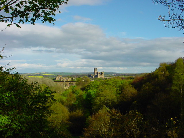
View of Durham from Flass Vale
Flass Vale is very important as it is an excellent oak wood. In Victorian times it held a formal garden and a curling pond. There are also beech and holly in this wood and it is possible to see jays, great spotted woodpeckers and tawny owls as well as all the normal garden birds. Turn south (right) along the east side of Flass Vale along a narrow path with terraced streets on your left. The path climbs stairs past the site of one of the original wells before water was supplied by pipes. You then come to the Durham Miners Hall. The first Miners Hall was on North Road in 1874 but moved to this site in 1915. The statues are of McDonald, Patterson, Crawford (who initialled the Miners’ Gala in 1874) and Forman. They were previously on North Road and after the move stayed there above the original hall which had convened to a cinema.
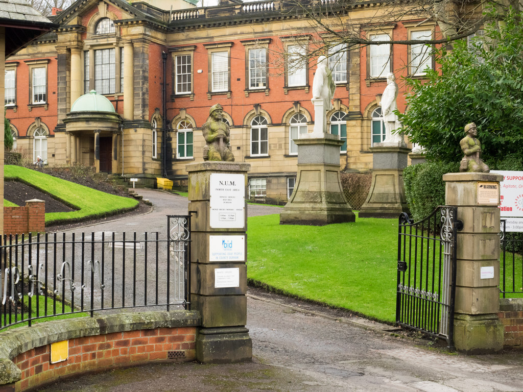
Durham Miner’s Hall
Statues on the original Durham Miner’s Hall
Proceed up Redhills and pass through a tunnel under the railway to Mistletoe Road and down to Hawthorn Terrace. The building on the far side was formerly the business of Harrison and Harrison. Harrison and Harrison were founded in 1861 in Rochdale before moving to Durham in 1872. They made the organs at Kings College Cambridge, Westminster Abbey and the Royal Festival Hall as well as carrying out rebuilds on 19 cathedral organs in the UK. They moved a few years ago to Meadowfield near Durham and are world famous.
Now head south (right) up Hawthorn Tecrace to May Street. Note the bottom house which shows that these houses were built in 1887 which was the Jubilee year and there is a bust of Victoria above the house. At the top of the street turn left to the next street and proceed uphill to the top, passing Farnley Tower on your right.
At Crossgate turn right towards the A167. On the right is the Neville’s Cross, erected by Ralph Neville to commemorate his victory. A full tour of this site is one of the other guided walks run by Durham County Council. Turn around and retrace your steps and staying on the north side follow a path down towards the city with the hedge on your right. After 100m, follow the steps down to the road and cross to Blind Lane. Take the steps up to Beech Crescent. The house at the bottom was the house of Peter Lee, although this is not indicated on the house. Peter Lee (1864 — 1935) rose from humble beginnings to be elected to Durham County Council which was the first Labour council in England. He subsequently became Chairman of the Council, was a lay preacher and was Secretary of the Durham Miners Association. He is perpetuated in having his name given to the new town of Peterlee. megafafa
Sanctuary Knocker of Durham Cathedral
The route continues through the allotments, after passing some modern housing with fine views of the Cathedral, and down to Prebends Bridge (built 1772 – 1777) and up to Durham Cathedral to the Sanctuary Knocker. Go through the North Bailey and to South Bailey and back to Prebends Bridge. Turn left and then cross the road on the marked footpath. Continue west on the footpath to the University of Durham Observatory. The Observatory was established in 1839 by WM Wharton and with the renowned Anthony Salvin as Architect. It housed a superb library which was transferred to the University library in 1953. During its existence it has performed many observations which have led to further knowledge of the universe.
Bridge Spanning River Browney on Lanchester Railway Path
Follow the footpath through the new Barratt development, passing at GR NZ256 416, the site of the former college to emerge onto the A167. Cross to go through to the A690 via Lowe Barn Estate. This area was the site of a Roman road now lost. On reaching the A690 cross with care and go behind a terrace of houses to a back lane with allotments on your left. Go uphill to GR 261418 where you turn left through the allotments for a short distance and then down a field to cross the River Browney by a footbridge to reach Relly Mill which is a small settlement of considerable age. Follow the west bank of the River Browney to the bridge and turn left (south) past Baxter Wood to the Lanchester Railway walk. This Railway was opened to carry from Langley Park and serve the valley. It was opened in 1862 and closed 1965. In its passage up the Browney Valley, it goes through attractive countryside. The area has a substantial number of threatened skylarks, some peewit (becoming scarce) and sand martins.
The railway walk is is now followed back to the start leaving the line at GR NZ 233445 to cross a footbridge. The path leads past the sewage works to the church at Witton Gilbert.
The post Sanctuary Way Stage 4 – Witton Gilbert to Durham Cathedral appeared first on Bill's Walks.
]]>The post Romaldkirk and the Reservoirs appeared first on Bill's Walks.
]]>Start: Village Green, Romaldkirk, DL12 9EE (GR NY994220). Park with consideration in the village.
Map: Explorer OL31 North Pennines – Teesdale & Weardale
Click to View Start Position of Google Maps
Today’s walk starts in the very attractive village of Romaldkirk which has three village greens. The low green where we are starting contains one of the village pumps and it is interesting to note that despite the proximity of the reservoirs which we will visit later, that the village did not get piped water until 1934. This was nearly 50 years after Hury and Blackton were constructed. The middle green was at one time cobbles and had stock pens as there were fairs held here in the 1800s and early 1900s but these were stopped due to the excessive drinking at them. Things do not change much over the years when human behaviour is concerned!
Romaldkirk has always been an agricultural village and did not have such direct contact with the Teesdale Quarries although the character of the village changed when the railway line opened and brought with it commuters who worked in Darlington etc. In the early 1950s there was an active railway station, a Post Office and a busy village school and earlier still there once was four pubs plus a brewery. Now only two remain and besides these are the old village stocks which no doubt subdued some of the drunkards at the old fair on the middle green.
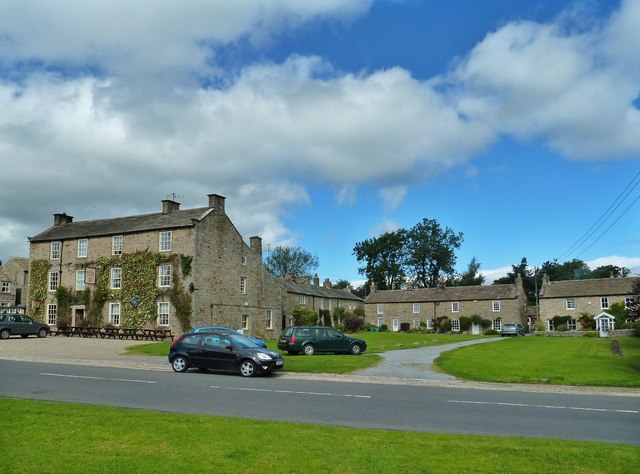
Romaldkirk Village
The parish church is dedicated to St Romald and has been known as the Cathedral of the Dales although I believe the church at Grinton in Swaledale has better fame in this respect. Nevertheless quoting WT Palmer in his “Wandering in the Pennines” published in 1951, “St Romalds is the only church bearing the name of Romald and nothing is known concerning the saint. The frescoes on the column in the nave suggest St Romuald of Ravenna (c956) and his famous visit to Venice and that could have been in the minds of the builders of the church but there was also a Saxon St Rumald or Rumwald of Northumbria and it is more likely that he was the one commemorated”.
The current structure belongs to the 12th Century and was refounded after this part of Teesdale recovered from the Conqueror’s ruthless expedition to subdue the north. Indeed in the Doomsday book the place is referred to as “waste”. I will leave it to yourselves to visit the church at your leisure.
We leave the village on the Hunderthwaite road (Hunderthwaite was a viking settlement meaning Low Meadows of Hundrethr, a Viking name and soon reach the old railway now converted to a walk by Durham County Council. This was originally opened as the Tees Valley Railway in 1868 and was nearly 9 miles long from Barnard Castle to Middleton. The two original structures of Lunedale and Baldersdale viaducts still stand and are used on the walkway. In 1957 the engine shed at Middleton was closed when the K1’s were replaced by diesel DMU’s and the line finally closed in 1964. In its heyday there were seven passenger trains daily as well as regular freight carrying quarry products from the quarries at Middleton.
We now take the track to West End Farm (at GR 987200) situated above the River Balder. To the north-west at Gill Field was a small coal mine in the early part of the 1900s and we continue west to Strathmore Arms which as the name suggests was at one time a pub. In the 1890 register the owner is registered as a victuallar and farmer. We proceed west on footpaths past Scoon Bank above and to the south of Hury Reservoir which was built in 1894 and covers 50 hectares. It is the best of the local reservoirs to observe birdlife and is well stocked with rainbow trout. It is a common misconception that Canada Geese have only been in the UK in latter years but records show five pairs nesting here in 1945.
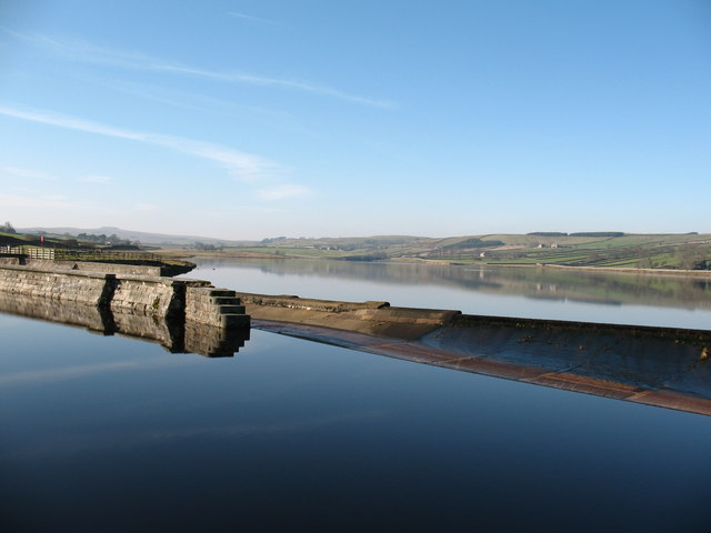
Hury Reservoir
We continue west to reach Blackton Reservoir which was built in 1896 and is shallower than Hury, before picking up the Bowes Alternative Section of the Pennine Way to arrive at Blackton Bridge. This marks the half way point of the Pennine Way on its route from Edale to Kirk Yetholm. Above us looms the dam of Balderhead Reservoir which was built in 1965 and covers 111 hectares. The earth dam when it was built was the largest in the country being 303 feet long and 157 feet high, holding back 4 million gallons of water. It is not widely known but the dam leaked for a period after its construction and additional work was required after its completion. A prize for the first person to metricate these figures!
Blackton Bridge
We turn to head east along the north side of Blackton passing Birk Hat which was formerly the home of Hannah Hauxwell. The field to the north is known as Hannah’s Meadow and is managed by Durham Wildlife Trust as a flower rich unimproved meadow. For the botanists, meadow foxtail, crested dogs tail and sweet vernal grass is found here along with other flowers rarely found now. In recent years, mainly through organisations like the North Pennines AONB, great efforts are being made to bring more meadows back to the “old” condition. We follow permissive paths alongside the reservoir to arrive at Hury and take the road up to Botany. It is now a simple route to the east over Romaldkirk Moor all the way back to Romaldkirk. Gracies Farm on the far side of Thackwood Beck is interesting as it occupies the site of a turf cottage built by Grace Scott who in the time of the Great Plague of 1836 fled there for refuge and never went back until the plague had gone. After escaping the fate of many of her old neighbours she lost her life through her cottage accidentally catching fire. Such is life!
Romaldkirk Moor
The post Romaldkirk and the Reservoirs appeared first on Bill's Walks.
]]>